Wincanton Footpaths Reopened after Years of Neglect
Early in 2008, we were asked by the chairman of the South Somerset Ramblers if we would be interested in becoming Wincanton's Parish Paths Liaison Officers (PPLOs). He had been approached by the Town Clerk, as Wincanton was in the embarrassing position of being one of the few councils without a PPLO!

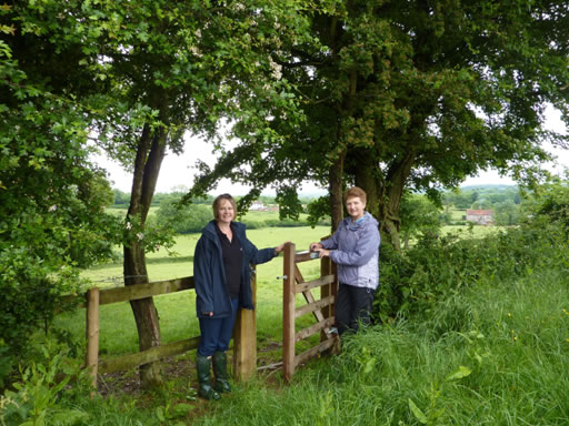
Eve and Janet inspecting a new gate on Hook Valley Farm
The 'Clear the Way Project' was set up in early 2008 by the County Council in an attempt to improve the access to and the condition of the county's footpaths. In 2002/3, only 35% of the county's footpaths were considered to be 'easy to use' which was well below the country's average of 62% (as measured in 2003/2004)! Although the county's countryside rangers were doing sterling work on clearing and maintaining our footpaths, it was an impossible task for them to walk, let alone look after, all the footpaths in the county. By setting up a team of volunteer PPLOs for each parish, this task could be achieved more successfully. The good news is that the surveys carried out during 2008/9 showed that 82% of the county's footpaths were now considered to be 'easy to use'.
 The role of a PPLO is to walk the local footpaths and report to our local countryside ranger (Eve Wynn) on the condition of stiles, gates, bridges, signposts and waymarks. Similarly, any obstruction is reported, too. As PPLOs we have endeavoured to cut back any vegetation which grows over stiles etc. during the summer and for this task, we have been provided with secateurs, loppers, and small pruning saws. Another important task is to help the 'Rights of Way Team' keep an accurate, up-to-date record of local landowners that have public rights of way crossing their land.
During the last two years, we have walked all the footpaths in the Wincanton parish during each year. We estimated that there are about 20 miles of footpaths in the parish but, in walking them, we probably cover twice that distance. A study of the appropriate map will show that the parish of Wincanton is a tilted dumbbell shape extending from Westleaze Farm in the north to the railway next to Buckhorn Weston in the south and from Holbrook House in the west to Higher Marsh Farm in the east. Anyone interested in viewing the Definitive Map of footpaths in Wincanton can view this by visiting www.somerset.gov.uk and searching for 'Public Rights of Way'. Next select the 'Request to view the Public Rights of Way Definitive Map and Statement'. Clicking on the 'Interactive mapping' in the 'Information and Resources' box will produce the map. Incidentally, the red marks on this map indicate the faults that are known to exist in Wincanton.
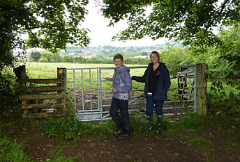
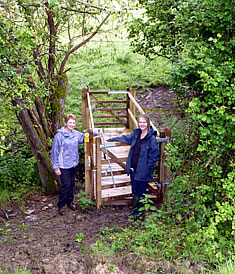
During the last two years we have cleared many stiles and through our contact with the local countryside rangers have persuaded them to open up pathways that were formerly blocked, e.g. Footpath WN 30/31 which runs north west from Higher Marsh Farm. Recently, we are thrilled to report that much work has been carried out on Hook Valley Farm where new gateways and two new footbridges have opened up this area again for the benefit of walkers.

A new 'Bristol' Gate

One of the two new footbridges on Hook Valley Farm
If anyone, especially those who walk certain footpaths regularly, perhaps when walking their dogs, would like to help, we would be delighted. We can be contacted on 01963 34965. Many parish councils form their own volunteer group to maintain their footpaths. We would be happy to coordinate. Any problems could be reported to us in the first instance. We could then assess the problem, deal with it if possible or if not, pass it on to Eve Wynn.
It is our hope that the residents of Wincanton will be encouraged to enjoy, respect and to use our local footpaths so that this part of our national heritage is passed on to future generations.
Comments
Login to comment!